


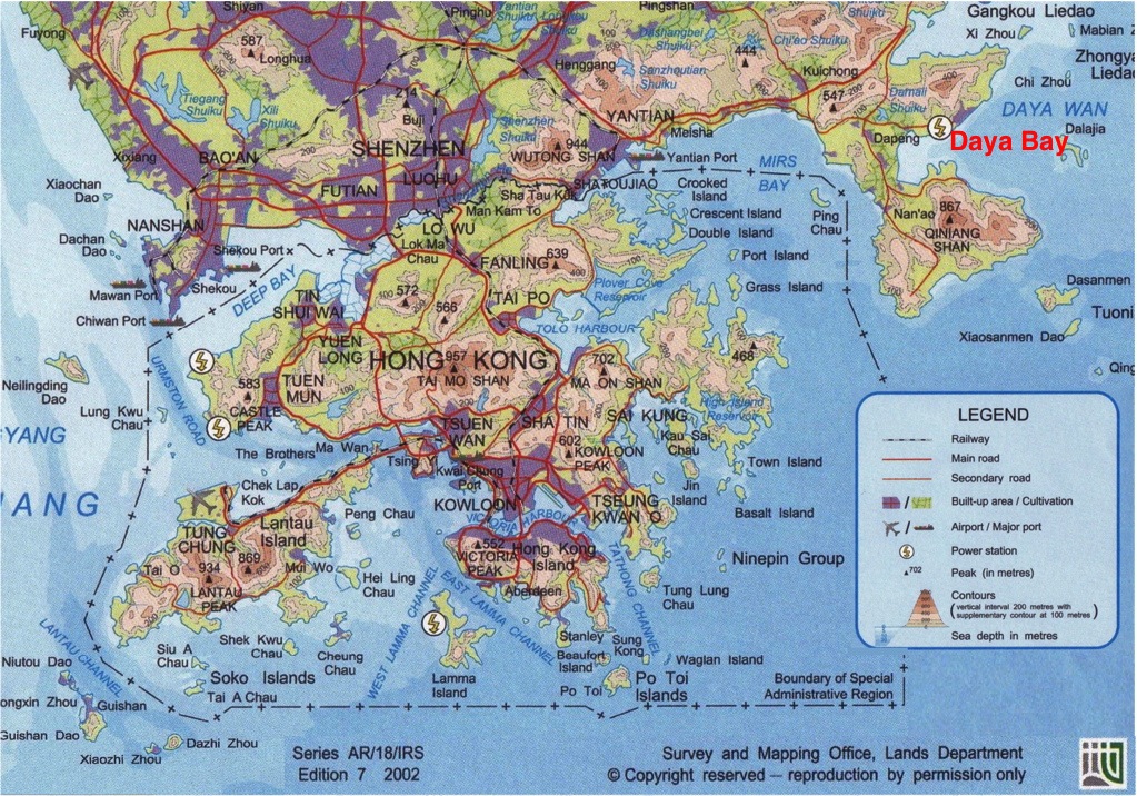
Map of Hong Kong with the Daya Bay nuclear power complex shown in the upper right corner.
The experimental site is inside the Daya Bay nuclear power facility which is in the Dapeng township of the Longgang Administrative District, Shenzhen Municipality, Guangdong Province. It is close to two mega cities, Hong Kong and Shenzhen and one medium city, Huizhou. The Shenzhen City is 45 km to the west, Hong Kong 55 km to the southwest, and the border of the Huizhou-Daya Bay Economic Development Zone 10 km to the north. There is no railway within a radius of 15 km. The road from the Daya Bay NPP to the Dapeng Township (Wang Mu) is a Class-II (12 m) type. The Dapeng Township is connected to Shenzhen, Hong Kong, and Guangzhou by highways which are either Class-I (25.5 m) or expressways (28 m). There are two shipping ports near the site, one on the east and the other on the west of the north coast of Daya Bay. Oil tankers to and from Nanhai Petrochemical, a $4.3 billion joint venture of Shell and China National Offshore Oil Corporation, use the east port. The Huizhou Harbor located on the Quandao Peninsula is 13 km north of the site.
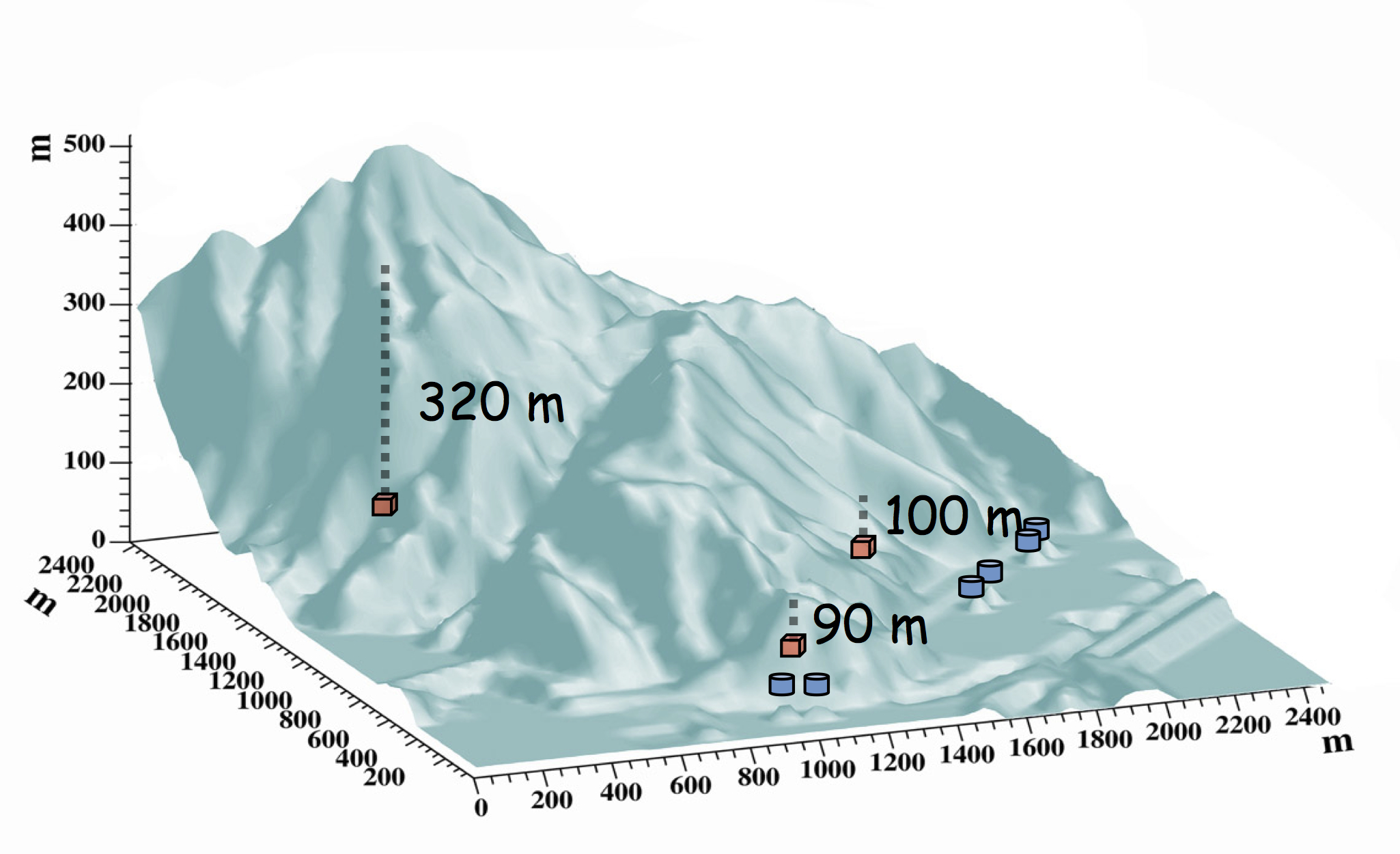
Topography of the experimental site. The blue boxes represent the location of the reactor cores. From left to right: the Daya Bay reactors, the Ling Ao reactors, and the Ling Ao II reactors. The red boxes show the locations and depths of the underground experimental halls.
The facility is located at 114°33'00" E and 22°36'00" N, on the east side of the Dapeng Peninsula and west of Daya Bay with the coastline running from southwest to northeast. The complex abuts hills and mountain ranges to the north. The slopes of the hills vary from 10° to 45°. Within 2 km of the site the elevation varies from 185 to 400 m. The summit, called Pai Ya Shan, is 707 m high relative to the Pearl River Delta (PRD). Due to the construction of the Daya Bay and Ling Ao nuclear power plants (NPPs), the southwest to southeast coastline is levelled to a height between 6.6 m and 20 m PRD.
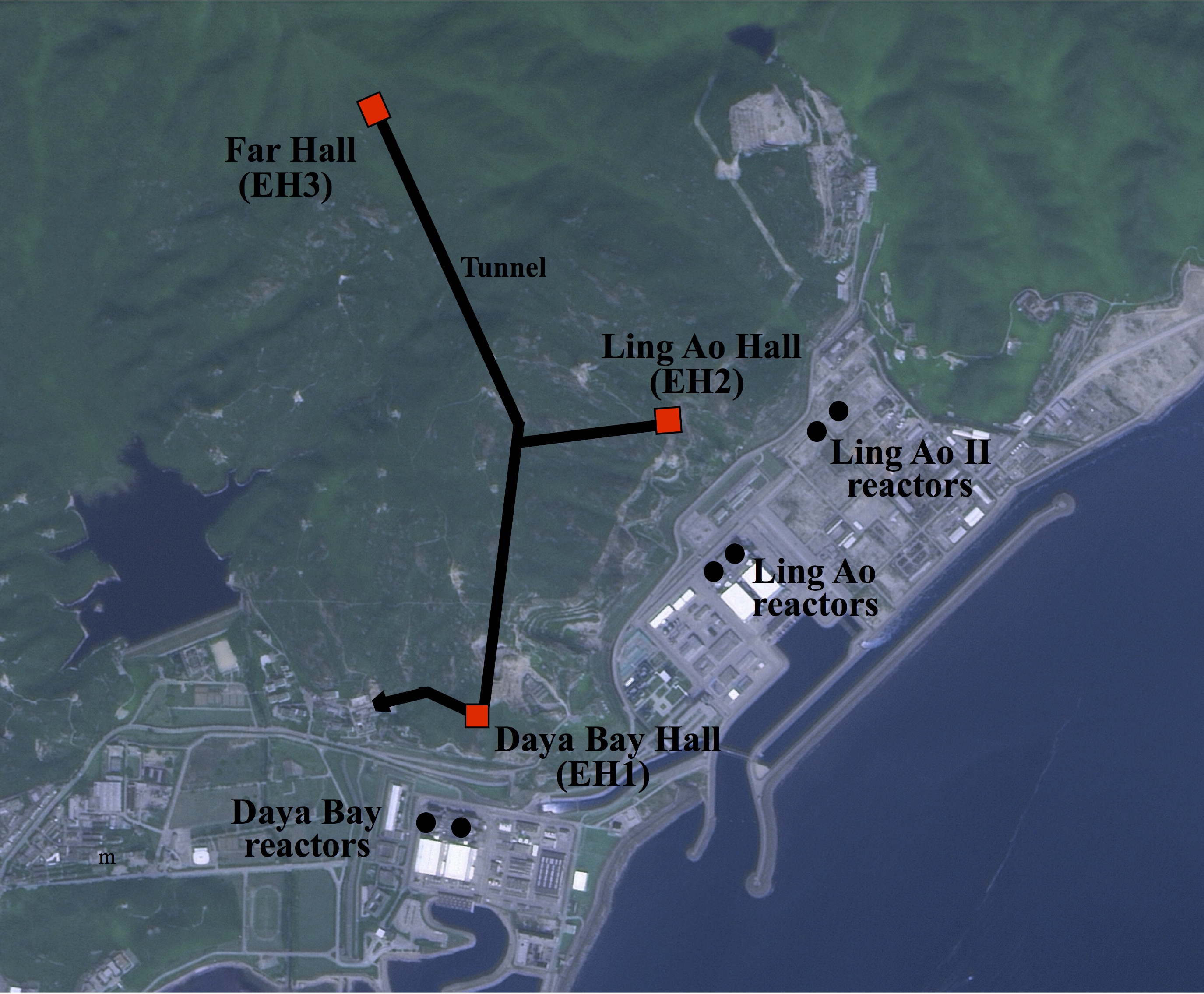
Satellite image of the Daya Bay nuclear power plant complex showing the location of the reactors, tunnels, and the underground experimental halls.
The experimental site is located in the southwest portion of the Lianhua Mountain fault, south of Pai Ya Shan. It is in the massif between the Wuhua-Shenzhen and Da Pu-Haifeng subfaults. There are very few faults close to the site. Hence the geology of the site is simple. Geotechnical survey and bore-hole drilling indicate the terrain is granitic with a few pockets. More details on the rock composition can be found here.